- Title
- RAN Tierras de Uso Comun
- Abstract
No abstract provided
- License
- Public Domain (PD)
-
+ Works in the public domain may be used freely without the permission of the former copyright owner.
+ For more info see http://www.copyright.gov/help/faq/faq-definitions.html. - Publication Date
- Dec. 8, 2021, 3:42 a.m.
- Type
- Vector Data
- Keywords
- Category
- Planning Cadastre
- Information used for appropriate actions for future use of the land. Examples: land use maps, zoning maps, cadastral surveys, land ownership.
- Regions
- Mexico
- Approved
- Yes
- Published
- Yes
- Featured
- No
- DOI
- None
- Attribution
- Consejo Municipal de San Quintin
- Name
- Arq. Luis Fernando Cañez Montoy (admin)
- arq.fernando.canez@outlook.com
- Position
- Director General
- Organization
- FC Arquitectos/Urbanistas Consultores
- Location
- Oficina 22710 Playas de Rosarito Baja California MEX
- Voice
- (664) 394-7977
- Fax
- None
- Keywords
- FC Arquitectos
- Identification Image
-


- Spatial Extent
- ---
- Projection System
- EPSG:32611
- Extension x0
- 574990.5003363256
- Extension x1
- 907150.3396906087
- Extension y0
- 3100796.8399303765
- Extension y1
- 3444038.7192879585
- Maintenance Frequency
- There Are No Plans To Update The Data
- Restrictions
- formal permission to do something
- Edition
- 2021
- Language
- Spanish
- Supplemental Information
No se provee información
- Spatial Representation Type
- vector data is used to represent geographic data
- Name
- Arq. Luis Fernando Cañez Montoy (admin)
- arq.fernando.canez@outlook.com
- Position
- Director General
- Organization
- FC Arquitectos/Urbanistas Consultores
- Location
- Oficina 22710 Playas de Rosarito Baja California MEX
- Voice
- (664) 394-7977
- Fax
- None
- Link Online
- /layers/geonode_data:geonode:ran_tierras_uso_comun_utm
- Metadata Page
- /layers/geonode_data:geonode:ran_tierras_uso_comun_utm/metadata_detail
- JPEG
- RAN Tierras de Uso Comun.jpg
- RAN Tierras de Uso Comun.pdf
- PNG
- RAN Tierras de Uso Comun.png
- Zipped Shapefile
- RAN Tierras de Uso Comun.zip
- GML 2.0
- RAN Tierras de Uso Comun.gml
- GML 3.1.1
- RAN Tierras de Uso Comun.gml
- Original Dataset
- RAN Tierras de Uso Comun.zip
- CSV
- RAN Tierras de Uso Comun.csv
- Excel
- RAN Tierras de Uso Comun.excel
- GeoJSON
- RAN Tierras de Uso Comun.json
- Shapefile Comprimido
- RAN Tierras de Uso Comun.zip
- Legend
- RAN Tierras de Uso Comun.png
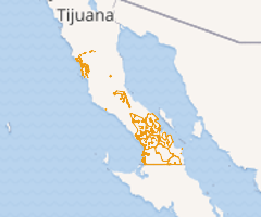
- Thumbnail
- RAN Tierras de Uso Comun.png
- OGC WMS: geonode Service
- Geoservice OGC:WMS
- OGC WFS: geonode Service
- Geoservice OGC:WFS
- Name
- Arq. Luis Fernando Cañez Montoy (admin)
- arq.fernando.canez@outlook.com
- Position
- Director General
- Organization
- FC Arquitectos/Urbanistas Consultores
- Location
- Oficina 22710 Playas de Rosarito Baja California MEX
- Voice
- (664) 394-7977
- Fax
- None
- Keywords
- FC Arquitectos